
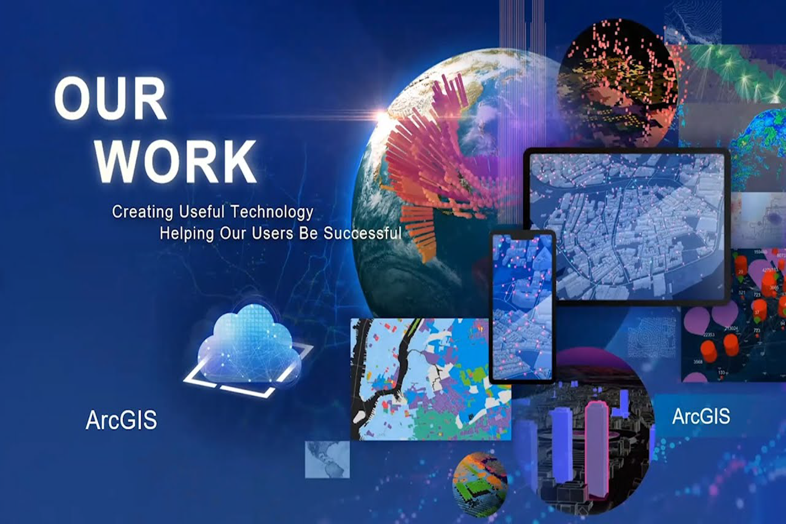
ESRI Development
- At IntelliNetworks, we specialize in building custom tools and workflows using ArcGIS Pro and ArcMap,tailored to streamline your geospatial tasks and analysis.
- Our Services Include:
- Custom Tool Development
- Python (ArcPy) scripts and models for data processing, automation, and advanced analysis.
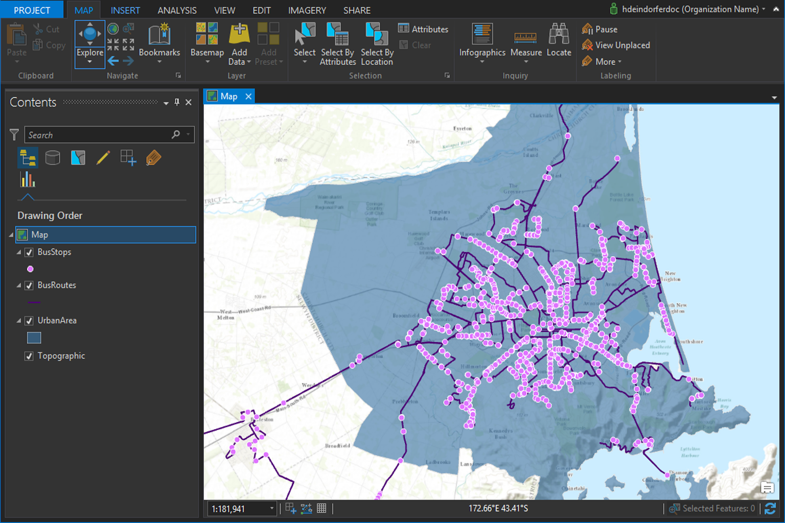
- Geodatabase Design
- Schema creation, topology rules, domains, and subtypes for structured data management.
- Map Production & Editing Workflows
- Smart templates, symbology, and editing tools for high-accuracy data capture and reporting.
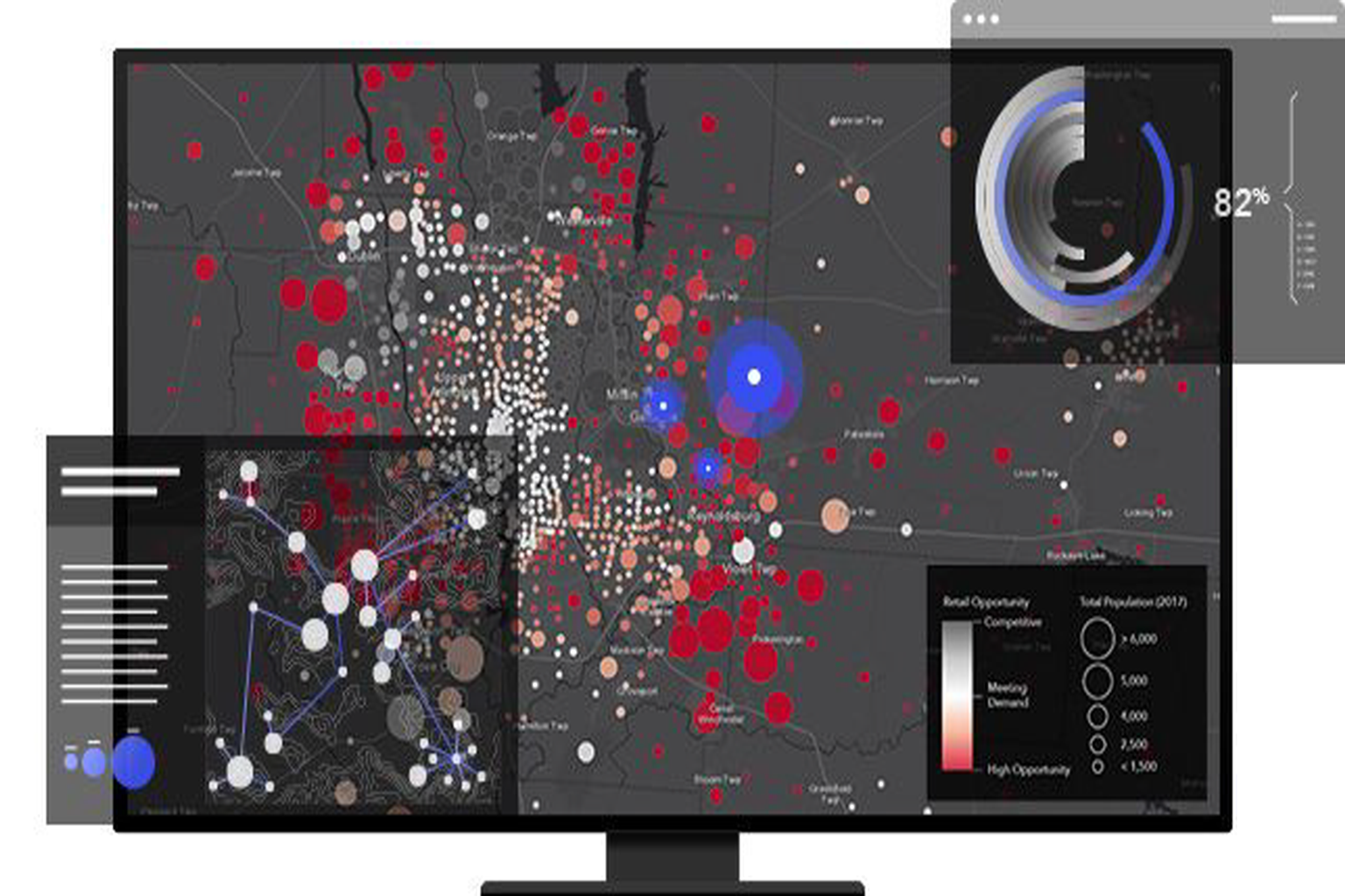
- Advanced Spatial Analysis
- Buffering, overlay, proximity, suitability modeling, and raster analysis using ArcGIS extensions.
- Integration with WebGIS & Databases
- Seamless sync with Enterprise Geodatabases, ArcGIS Online, and Portal for ArcGIS.
WebGIS Development
At IntelliNetworks, we craft dynamic and user-friendly WebGIS solutions that bring your spatial data to life—accessible anytime, anywhere.
Our Expertise Covers:
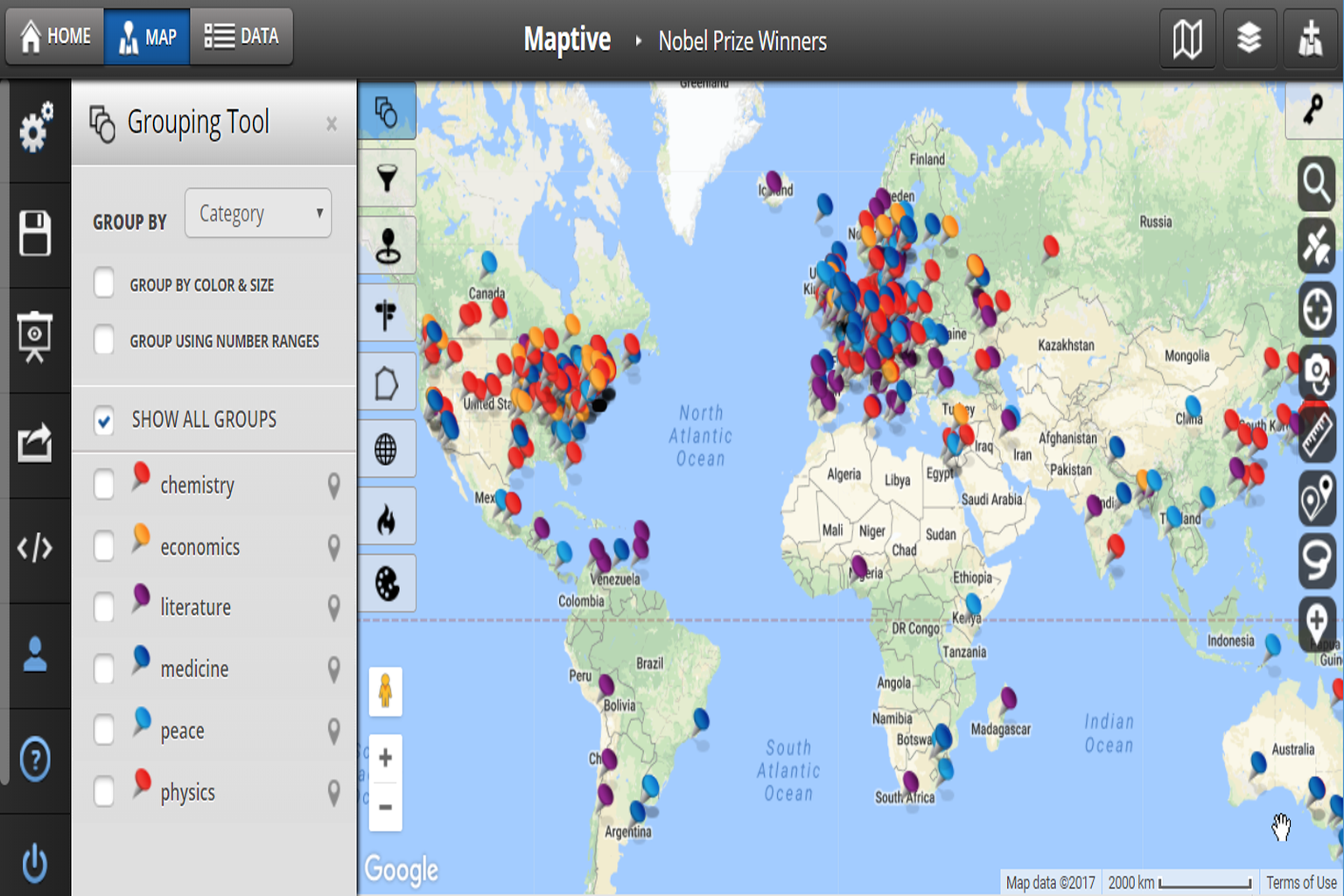
Interactive Web Maps
Built using ArcGIS Web AppBuilder, Experience Builder, Leaflet, OpenLayers, and MapLibre.
Custom Dashboards & Tools
Real-time data visualization, filters, geoprocessing widgets, and map-based reports.
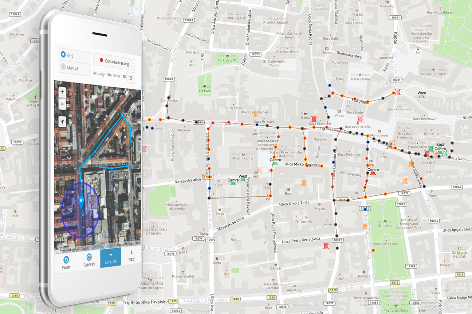
Mobile-Responsive Design
Optimized for desktops, tablets, and smartphones for field and office use.
Backend Integration
REST APIs, spatial databases (PostGIS, SQL Server), and secure authentication.
Cloud & On-Premise Deployment
Scalable solutions hosted on ArcGIS Online, ArcGIS Enterprise, or custom servers.
Open Source GIS Solutions
We empower organizations to break free from costly licenses using robust open-source GIS tools. Our team delivers end-to-end solutions that scale and perform across environments.
Key Services:
-
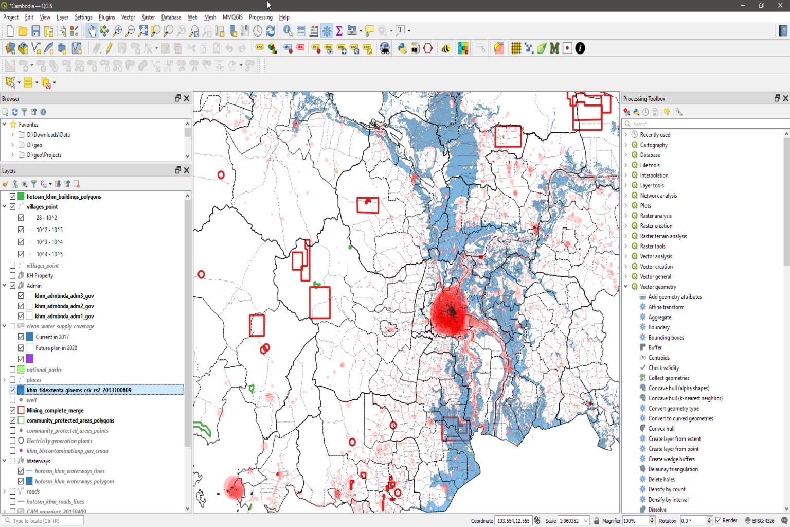
Custom GIS systems using QGIS, GeoServer, MapServer, and GRASS GIS
-
Spatial database architecture using PostgreSQL/PostGIS with topology rules and spatial indexing
-
Advanced styling using SLD, QML, CartoCSS
-
WMS, WFS, and WMTS service configuration and hosting
-
Field-to-office workflows with QField, Mappt, and Open Data Kit (ODK)
ESRI Development & Enterprise GIS
As ESRI specialists, we help clients leverage the full ArcGIS ecosystem — from desktop to cloud — with tailored development and system integration.
Key Capabilities:
-
Desktop development with ArcGIS Pro, model automation via ModelBuilder, and scripting in ArcPy
-
Web applications using ArcGIS Web AppBuilder, Experience Builder, and ArcGIS Dashboards
-
Setup and management of ArcGIS Enterprise and ArcGIS Online environments
-
Integration with Survey123, Field Maps, and custom mobile workflows
-
Full migration and deployment of Utility Network (UN) models, including network tracing, domains, connectivity rules, and quality checks
Utility Mapping – Gas, Electrical & Water Networks
We deliver high-accuracy mapping solutions to help utilities manage infrastructure in real time.
Industries
Gas: Pipelines, valves, pressure zones
Electric: Lines, poles, transformers, substations
Water: Pipes, hydrants, meters, pump stations
Services
-
Utility asset digitization
-
CAD/scanned drawing conversion
-
3D modeling of infrastructure
-
Real-time data collection
-
Dashboards for monitoring and analysis
WebGIS & Interactive Mapping Applications
We build dynamic, map-driven applications that bring GIS to the browser and the mobile screen.
Frontend Capabilities:
-
Frameworks: Angular, React, Vue
-
Mapping Libraries: Leaflet, MapLibre, OpenLayers, CesiumJS
-
Responsive UI/UX design for all screen sizes
-
Theming and branding to match your enterprise identity
Backend Capabilities:
-
APIs & Services in Django (Python), Flask, Node.js
-
Integration with REST APIs, geocoding, routing, and live sensors
-
Secure authentication and role-based access
-
Real-time data update and visualization
Data Conversion & Migration Services
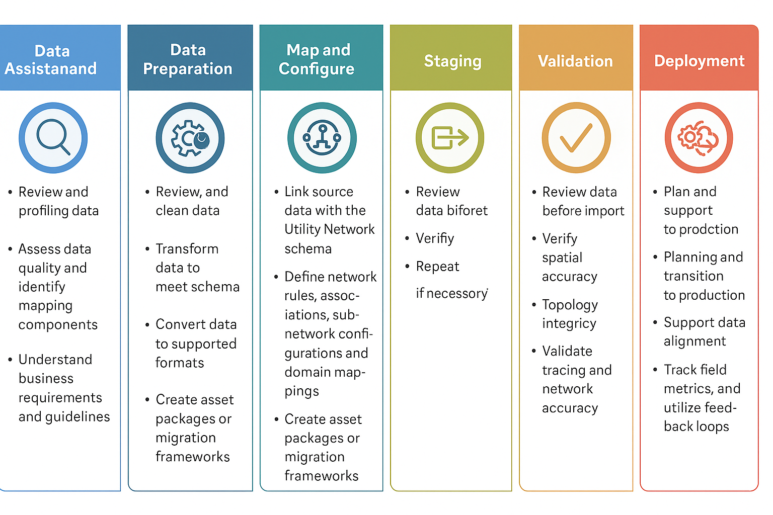
Empowering Utilities with Seamless Esri Utility Network Migration
At IntelliNetworks, we specialize in transforming traditional geometric network data into the Esri Utility Network (UN) model. With deep expertise in utility data and a focus on consistency, integrity, and operational efficiency, we help utilities navigate digital transformation smoothly.
Our proven migration workflow ensures high data quality, implements essential business rules, and aligns with modern distribution and compliance standards. Backed by extensive experience, we deliver reliable, lossless transitions tailored to each client’s unique needs.
Our Technology Stack
We leverage modern, reliable tools for spatial development, automation, and visualization. Our expertise spans GIS platforms like ArcGIS Pro, QGIS, and GeoServer; programming with Python, JavaScript, and SQL; and web development using Angular, React, and Django. We work with spatial databases like PostGIS and GDB, and utilize tools such as FME, ArcGIS API for JS, and Survey123 for mobile GIS—ensuring efficient, scalable, and field-ready solutions.

AI & Machine Learning in GIS – GeoAI
GeoAI combines the power of Artificial Intelligence with Geospatial Technology to unlock smarter, faster, and automated spatial insights. At IntelliNetworks, we leverage AI and Machine Learning to automate feature extraction, classify land use, detect patterns, and predict spatial trends—enhancing the efficiency of GIS workflows. Our custom GeoAI solutions support telecom planning, LiDAR data processing, urban mapping, and more—driving intelligent, data-driven decisions across industries.