

LiDAR Data Acquisition
Capture high-density spatial data using aerial, drone-based, or mobile LiDAR for a wide range of terrains and environments.
LiDAR is widely used for:
-
Topographic mapping
-
Utility and infrastructure mapping (e.g., power lines, roads)
-
Forestry and vegetation analysis
-
Flood risk assessment and hydrology
-
Urban planning and smart city development
Point Cloud Classification
Our team uses both automated algorithms and manual editing to accurately classify LiDAR point clouds into key features such as ground, vegetation, buildings, poles, wires, and other assets. This structured classification enhances usability for various engineering, planning, and asset management applications.

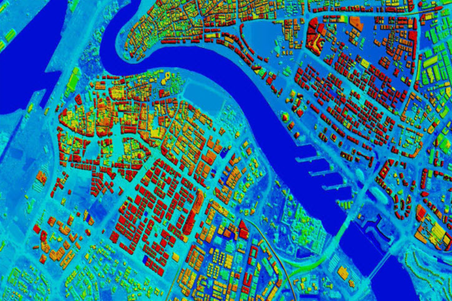
Digital Terrain & Elevation Models
We generate highly detailed Digital Terrain Models (DTMs) and Digital Elevation Models (DEMs) from raw LiDAR data, enabling accurate contour mapping, slope analysis, flood risk studies, and earthwork calculations. These elevation datasets serve as a foundation for engineering and environmental modeling.
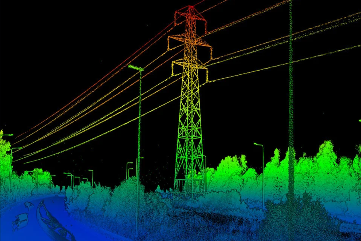
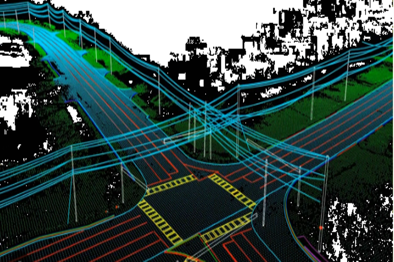
Power Line & Corridor Mapping
We specialize in transmission and distribution line analysis, identifying pole locations, wire attachment points, and performing sag, clearance, and encroachment analysis. Our LiDAR-based corridor mapping ensures safe, regulation-compliant, and optimized utility infrastructure layouts.
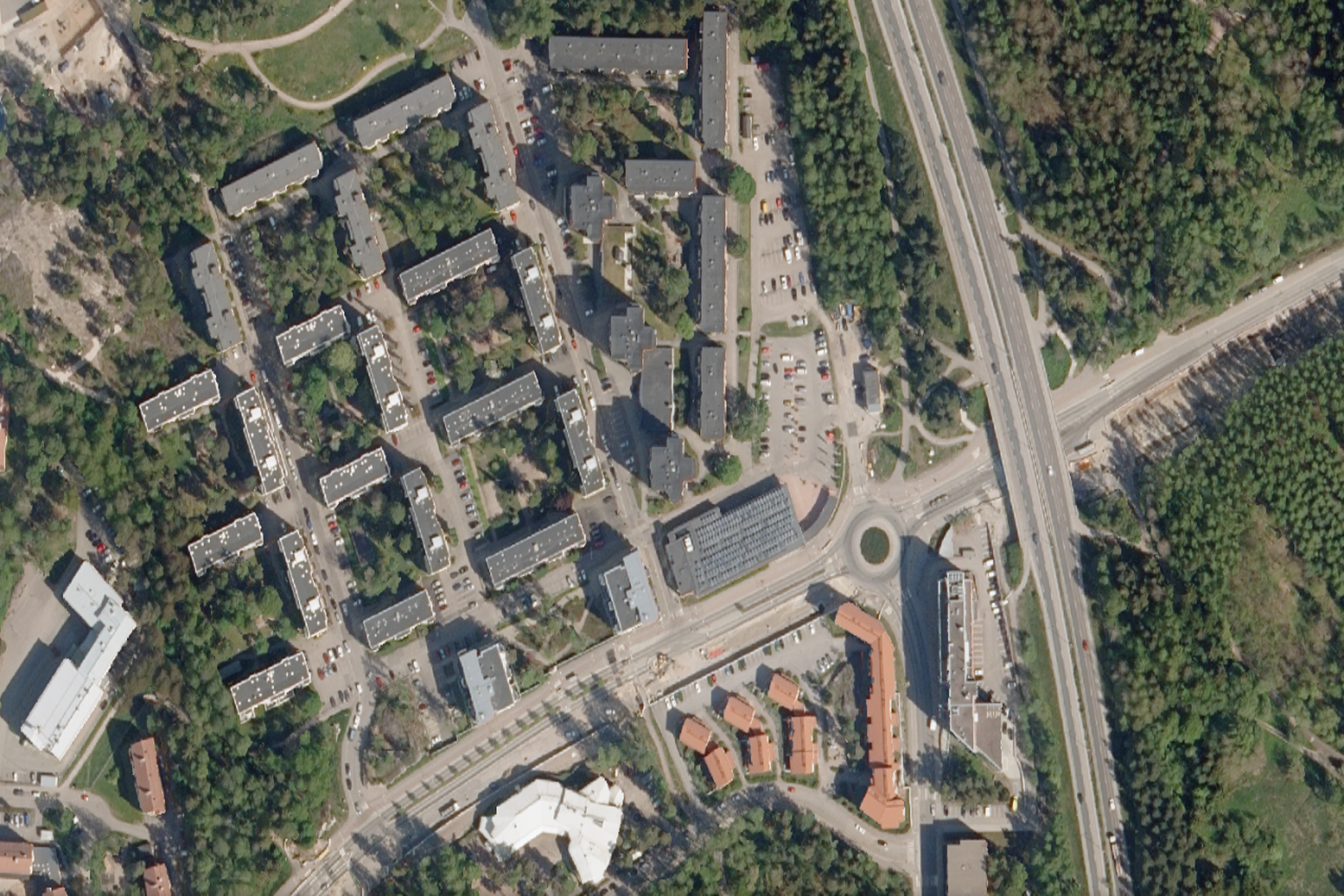
Orthophoto Generation
Using LiDAR-aligned imagery, we create georeferenced orthomosaics with high spatial accuracy. These orthophotos serve as reliable base maps for asset tracking, site analysis, and design overlays in both urban and remote project areas.

3D Modeling & Visualization
Our LiDAR-derived 3D models bring projects to life with precise, immersive representations of terrain, structures, and infrastructure. These models support planning, design, stakeholder presentations, and integration into BIM and simulation platforms for enhanced spatial understanding.
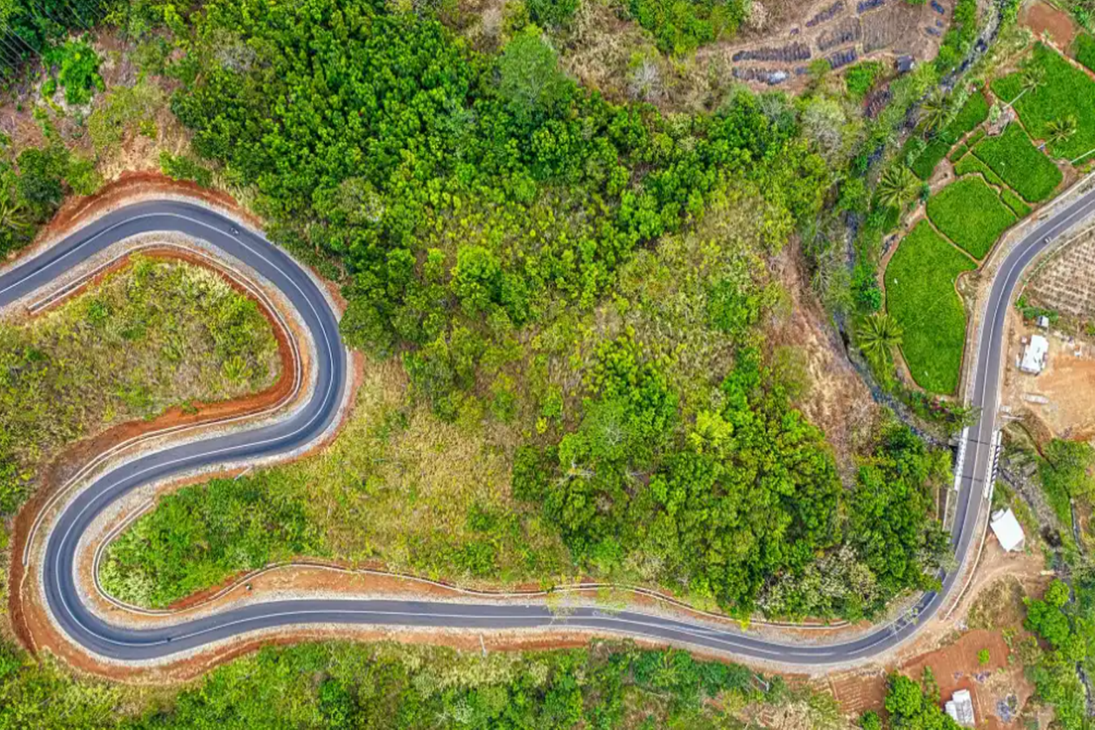
Roadway & Transportation Mapping
IntelliNetworks offers advanced LiDAR-based roadway and transportation mapping services, delivering high-resolution 3D data for accurate planning, analysis, and design. Our experienced team leverages state-of-the-art LiDAR technology to capture precise elevation models, roadway alignments, lane markings, and surrounding infrastructure. From highways to urban streetscapes, we provide detailed and georeferenced datasets that support roadway engineering, traffic analysis, asset management, and safety assessments. Our solutions are tailored to meet DOT standards and help clients reduce project timelines, improve accuracy, and enhance decision-making for transportation networks.
LiDAR to GIS/CAD Integration
At IntelliNetworks, we bridge the gap between raw LiDAR data and actionable design through seamless GIS and CAD integration. Our specialized team transforms complex point cloud datasets into accurate, structured formats compatible with leading GIS and CAD platforms. From terrain modeling and contour generation to utility mapping and infrastructure planning, we ensure spatial accuracy and data integrity at every stage. Whether you're working in ArcGIS, AutoCAD, MicroStation, or Civil 3D, our integration services empower engineers, planners, and GIS professionals with geospatial intelligence ready for design, analysis, and implementation.
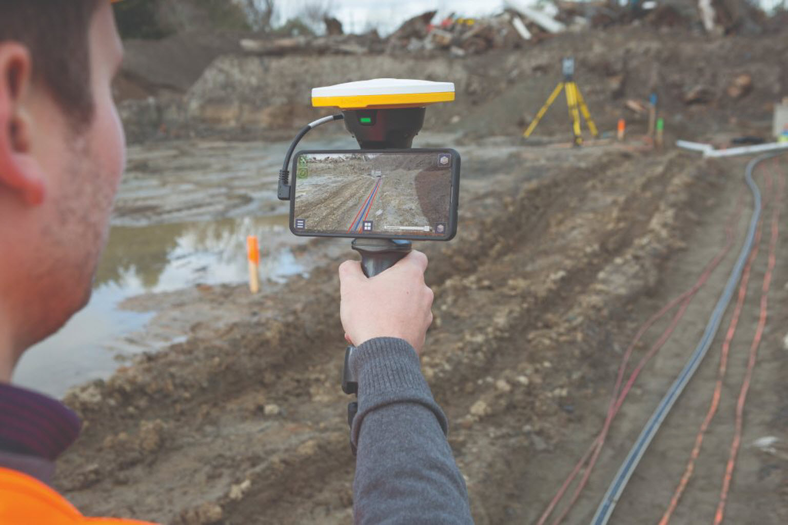
ViDoc Data Processing & Georeferencing
At IntelliNetworks, we specialize in high-precision ViDoc data processing and georeferencing services, delivering reliable spatial intelligence for a wide range of applications. Our expert team extracts accurate coordinates and spatial references from ViDoc scans, ensuring seamless integration with GIS platforms and engineering tools. Whether it's for utility mapping, urban planning, infrastructure inspection, or terrain modeling, our advanced workflows guarantee quality outputs with enhanced positional accuracy. We help clients convert raw ViDoc data into actionable geospatial insights—supporting smarter, faster, and more informed decisions.